About Sydney NSW
Sydney Australia Tourism
Activities
Places to Visit
Places to Eat
- Sydney City Restaurants
- Newtown Places to Eat
- Bondi Places to Eat
- Blue Mountains Places to Eat
- Oxford St Restaurants Sydney
- Manly Beach Places to Eat
- Places to Eat at The Rocks
- Thai Town Places to Eat
- Inner Sydney Places to Eat
- Sydney Chinatown Restaurants
- Bondi Junction Restaurants
- Darling Harbour Restaurants
- Darlinghurst Restaurants Sydney
- Kings Cross Restaurants
- Cronulla Places to Eat
- Camperdown Restaurants
- Bowral Restaurants NSW
- Restaurants at Palm Beach
Sydney Information
Getting Around
Things to Do
- Exhibitions, Events and Festivals in Australia
- Beaches at Cronulla
- Berrima
- Sydney Itineraries
- Sydney Kids Activities
Sydney Surrounds
- NSW Tourist Guide
- Sydney Surrounds
- Hunter Valley
- Darling Harbour Places to Eat
- Goulburn War Memorial Museum
Places of Interest NSW
Native Animals
Map Sydney City
Map showing locations of places of interest, attractions and museums. From the Sydney Opera House, Kings Cross to Darling Harbour and the City center. More about Sydney Inner City Sydney CBD City.
Next Picture: Map of Sydney CBD East - Map of Sydney CBD East.
Previous Picture: Map of Kings Cross - Map of Kings Cross.
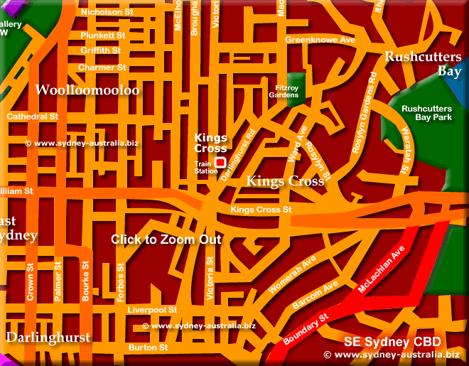
Kings Cross and Darlinghurst
Kings Cross and Darlinghurst has numerous restaurants to try, while the Cross shows its alternative side at night. Known as the red light district of Sydney, at night the place booms with entertainment, nightclubs and pubs. More about Kings Cross Sydney - Restaurants, Entertainment and Nightlife.
- Darlinghurst
- East Sydney
- Elizabeth Bay
- Kings Cross
- Kings Cross Train Station
- Fitzroy Gardens
- Rushcutters Bay Park
- Woolloomooloo
Find Museums and Attractions alphabetically: location Find Sydney Tourist Attractions by Map Alphabetically.
Sydney Hotels
Main Photo: Sydney City Map - Click to Zoom Out © www.sydney-australia.biz
Search the Australia Tourist Guide |


