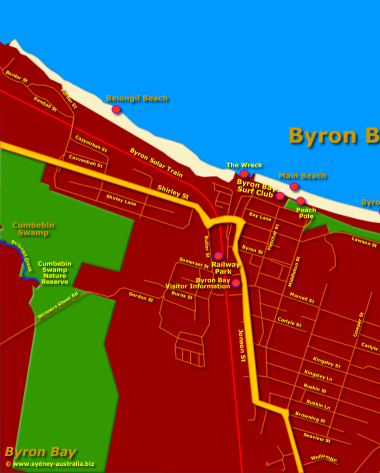
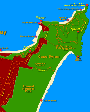
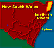
Map: Byron Bay Places to Visit - Click to Zoom Area or see the New South Wales Maps. © www.sydney-australia.biz
Maps of New South Wales
Sydney Australia Maps
North NSW Maps
- Central Coast Map, NSW Beaches, National Parks, Towns
- Hunter Valley Map NSW
- Map of the North Coast NSW
- Mid North Coast Map NSW - Attractions, Places of Interest
- Far North Coast Map NSW
Northern Rivers NSW
South NSW Maps
- Macarthur Region Map
- Southern Highlands Map NSW
- Illawarra and Wollongong Map, NSW
- South Coast Map NSW
- Far South Coast Map NSW
West NSW Maps
NSW Maps
- Maps of New South Wales
- South West NSW Map
- North West NSW Map
- North East NSW Map
- South East NSW Map
- Map of NSW Australia
- West NSW Map
- East Coast NSW Map
- NSW Regions Map, Australia Tourist Information
- NSW Map - Australia Tourist Guide
- NSW Touring Map
- Mimosa National Park
Australia Tourist Guide
Byron Bay Map showing Beaches and Places to Visit
Byron Bay NSW. The seaside holiday atmosphere of this coastal town with its shopping, surfing and swimming beaches and its growing collection of restaurants make a popular stopoff on the Sydney to Brisbane Pacific Highway Route. See more about Visit Byron Bay NSW.
The beaches here are amongst the best New South Wales has to offer, with it are the diving and snorkel sites that will leave life-long memories.
Main Beach
Main Beach is protected by the Byron Bay Surf Club. Swimmers, particularly young families are advised to go here. Swim between the flags, people!
Wategos Beach
Wategos has great views and even picnic sites to enjoy. Located some two kilometres from the town’s centre.
Little Wategos is also known for its surf. One nice way to get there is along the Cape Byron Walking Track. Just further along this track are stupendous views of the coastline and the ocean. With a bit of luck, spot turtles and dolphins here.
The Pass
The Pass, also very scenic is known for its great surf. Waves form long right-handed tubes on a good day. World famous, in fact, amongst surfers.
You can also find good snorkelling and diving here, especially around the Cape and at Fisherman’s Lookout.
Also, a little known beach here between Clarkes Beach and the Pass, is Captain Cooks Beach. Usually calmer than the other beaches, great for idling with a beach umbrella and a good book, interspersed with lazy swims in the cool aqua waters.
Clarkes Beach
Clarkes Beach is another sandy beach, great for lying down on and relaxing. Swimming and snorkelling is also enjoyed here, you can spot humpback whales here in their season.
Tallow Beach
You can also find good surf breaks along Tallow Beach. Tallow is backed by the Arkawal National Park and is worth a visit or more just for that.
Swimmers should be aware of the rips that run along this long beach. The Cosy Corner is probably best for those keen on swimming.
On the Rail Line (Red on the Map)
The Byron World First Solar Train: A return service, open 364 days a year, except Christmas Day. This fully restored two carriage heritage train is powered by solar energy! The first of its kind, with probably many more to come, hails from the late 1940s.
Running along a three kilometre coastal track, the ten minute ride on the train links Byron Town Centre with the North Beach precinct and the Byron Arts Estate.
The Eastern Point
The farthest eastern point of the Australian continent is here. If your exploring Australia, a must go to spot to visit.
See the surrounds of Byron Bay Map:
NSW Northern Coast Further Reading
Northern Rivers Further Reading
Main Photo: Byron Bay Places to Visit - Click to Zoom Area or see the New South Wales Maps.
Search the Australia Tourist Guide |


