Maps of the Northern Territory NT
- Northern Territory Maps Australia
- Northern Territory Map NT
- North West Northern Territory Map NT
- North East Northern Territory Map
- SW Northern Territory Map - Red Centre Australia
- South East NT Map
- Darwin Surrounds NT Map
- Uluru Kata Tjuta - Ayers Rock
Darwin Maps
- Darwin Map CBD - Australia NT
- Street Map of Darwin Australia
- Darwin Inner City Map NW
- Darwin Central Map NE
- Darwin City Map SW
- Darwin CBD Map SE
Alice Springs Map
Australian Maps
- Australia Map
- Australia States Map
- Australia National Parks Map
- Australia National Highways Map
- Australia Rail Map
- Australia Map
- ACT Map
- Tasmania Map
- Queensland Maps
- Gold Coast Map Queensland
- Maps of South Australia and SA Tourist Information
- Western Australia Map
Australia Tourist Guide
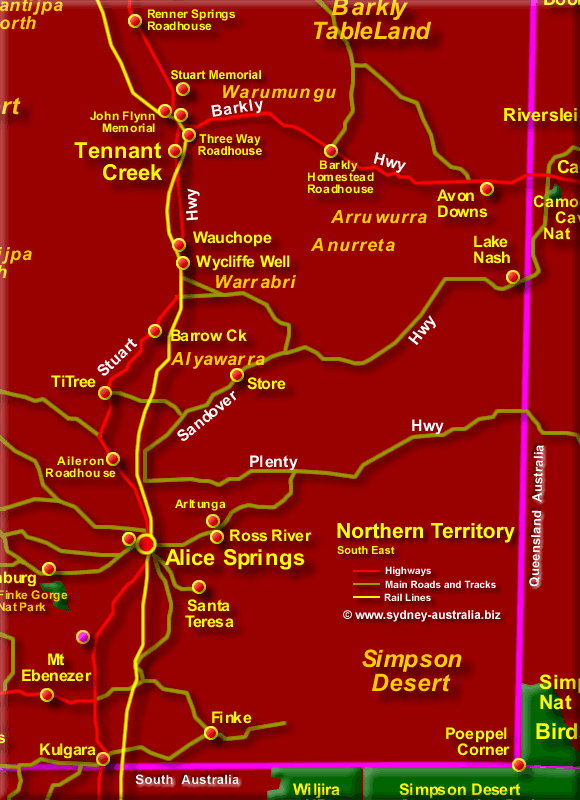
South East NT Map
Covered by the Simpson Desert to the South, with Alice Springs as the main city. Over four hundred thousand visitors a year come to this desert city every year.
Alice Springs is a good place to base yourself for exploring this region. There is plenty of things to explore in the town, including a growing collection of restaurants, hotels and bars.
South East of the Northern Territory
- Alice Springs Australia
- Tennant Creek
- Kulgara
- Ross River
- Santa Teresa
- Finke
- Finke Gorge National Park
- Poeppel Corner
- Simpson Desert
- Ti Tree
- Mt Ebenezer
Next Picture: South West NT Map - South West NT Map.
Previous Picture: North East NT Map - North East NT Map.
South West of NT
- Tanami Mine
- Tanami Desert
- Kings Canyon
- Uluru Kata Tjuta National Park
- Uluru (Ayers Rock)
- Uluru National Park
- Curtin Springs
Northern Territory North West
- Darwin Australia
- Adelaide River
- Daly River
- Daly Waters
- Gregory National Park
- Garig Gunak Barlu NP
- Timber Creek
- Kakadu National Park
- Katherine
- Litchfield National Park
National Parks
You can find out about the many parks and reserves in the Territory here: Northern Territory National Parks.
NT Accommodation
Main Photo: Map of the Northern Territory South East - Click to Zoom Out
Search the Australia Tourist Guide |
Australia Tourist Guide -> Northern Territory -> Australia Maps -> Northern Territory Map -> South East NT Map


