WA Maps Western Australia
- Western Australia Map
- Perth CBD Map
- East Perth CBD Map
- West Perth CBD Map
- Greater Perth Surrounds Map WA
National Parks
- Ningaloo-Shark Bay
- WA National Parks and Reserves Map
- North East WA National Parks and Reserves Map
- North West WA National Parks and Reserves Map
- National Parks and Reserves Map South West WA
- National Parks and Reserves Map South West WA
Regional Maps
- North Western Australia Map
- North Coast WA Map
- North Central WA Map
- North East WA Map
- Central West WA Map
- Central Western Australia Map
- East Central WA Map
- South West Western Australia Map
- South Central WA Map
- South East WA Map
WA State Maps
- SE Map of Western Australia WA
- SW WA Map
- NW Western Australia Map
- NE Western Australia Map
- State WA Map South West
- State WA South East Map
- State WA North West Map
- State WA North East Map Australia
Maps of Australia
Northern Territory
South Australia
Tasmania
Victoria
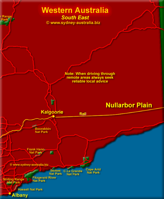
State WA South East Map
The South East of WA has Esperance with dramatic coast scenery. Four beautiful national parks to explore nearby include Cape Arid, Cape Le Grand, Peak Charles, Stokes Inlet.
- Kalgoorie WA
- Esperance
- Gwalia
- Hopetoun
- Menzies
- Leinster WA
Next Picture: South West WA - South West WA.
Previous Picture: North East WA Map - North East WA Map.
The Pipeline: Mundaring on the west coast to Kalgoorlie in the east is popular way to see Western Australia, following the Golden Pipeline Heritage Trail. 560km long and built in 1906 to supply water to the gold rich Outback Region of Kalgoorlie - a revolutionary engineering achievement.
Western Australia Places of Interest
Among the many Western Australia places of interest along the way, there are those that reveal the heartbreak and fortunes of the Western Australia Outback gold diggers and the many others who lived and died there.
Perth Australia as its gateway, Western Australia covers some 2.5 million square miles and has unique flora and fauna, an arid outback, jagged coastlines of cliffs and pristine beaches.
Western Australia Hotels
For Australia hotels, see Hotels in Australia.
Main Photo: South East WA - Click to Zoom Out
Search the Australia Tourist Guide |


