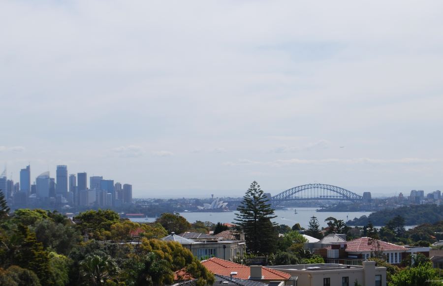
Photo: Sydney Harbour as seen from South Head
Previous Manly Beach Next South Bondi Beach
Sydney Australia Region
Places of Interest
Upper Northern Beaches
- Avalon Beach
- Restaurants in Avalon
- Bilgola Beach
- Collaroy Beach
- Newport
- Newport Restaurants
- Palm Beach
- Barranjoey Lighthouse
- Pittwater
- Warriewood Beach
Lower Northern Beaches
- Curl Curl Beach
- Dee Why Beach
- Long Reef Beach
- Mona Vale
- Places to Eat in Mona Vale
- Warriewood Beach NSW
- Narrabeen Beach
- Narrabeen Restaurants
- Manly
- Manly Beach
- South Curl Curl Beach
- Shark Dive at Manly
Eastern Beaches
- North Bondi Beach
- South Bondi Beach
- Tamarama Beach
- Sydney Eastern Beaches Walk
- Bronte Beach
- Coogee Beach Map
South
Greater Sydney Region
Sydney Harbour
Harbour Heads
Between north and south Sydney is the harbour, which is seen as traditionally dividing Sydney between South and North. The metal Sydney Harbour Bridge is testimony to this, having been built in the 1930s to make it simpler for people and traffic to cross, other than using ferries.
Ferries and their modern counterpart, Jetcats, are actually still a popular way to cross over from one side to the other. With them, you can visit places as far as Parramatta or the Northern Beaches suburb of Manly Beach, or closer by, such as Taronga Zoo or Darling Harbour.
Heads of Sydney Harbour
Harbour Cruises
Either way, enjoying the scenery and the experience is a memorable experience. Another good way to enjoy the harbour is to take one of the many harbour cruises available at Circular Quay, at the foot of the city, or Darling Harbour, located a short fifteen minute walk west from the center of the city.
Manly Ferry and Sydney Harbour
Beaches
There are a number of beaches on Sydney Harbour, which normally provide calmer waters than those found on many of Sydney’s many ocean beaches.
Sydney Harbour National Park
Both North Head and South Head, as well as key parts of the foreshore of Sydney Harbour are part of the Sydney Harbour National Park.
Sydney Beaches
The beaches in Sydney are divided essentially into the southern and east beaches on one side of Sydney Harbour with the Northern beaches further north. Divided by Sydney Harbour, the outlet to the ocean is seen on the bottom photo, marked by North Head and Manly on the other side of the divide, with the photo taken from the Gap at South Head.
Further Reading
Main Photo: Sydney Harbour as seen from South Head
Search the Australia Tourist Guide |

